
Failu:Brügge (B), Groenerei -- 2018 -- 8493-7.jpg

Tämän ezikaččelun suurus: 800 × 533 pikselii. muut rezol'uciet: 320 × 213 pikselii | 640 × 426 pikselii | 1 024 × 682 pikselii | 1 280 × 853 pikselii | 2 560 × 1 706 pikselii | 6 716 × 4 475 pikselii.
Alguperäine tiijosto (6 716 × 4 475 pikselii, tiijoston suurus: 16,15 MiB, MIME-tiippu: image/jpeg)
Yhtehvedo
| Kuvavus |
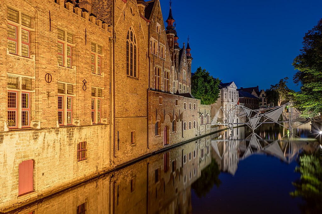
Deutsch: Groenerei und Landhuis van het Brugse Vrije (aufgenommen von der Blinde Ezelbrug), Brügge, Belgien
Zu sehen ist ebenso die Brücke „BRUG“ zur Triennale Brugge 2018 von Jaroslav Kokakiewicz. English: Groenerei and Landhuis van het Brugse Vrije (taken from Blinde Ezelbrug), Brügge, Belgium
العربية: جرونيري, بروج، بلجيكا
Français : Verdure et maison de campagne du libre de Brügge (photographié par l’aveugle Ezelbrug), Brügge, Belgique
Polski: Kanał Groenerei oraz budynek Landhuis van het Brugse Vrije (sfotografowane z mostu Blinde-Ezelbrug) w Brugii, w Belgii.
Українська: Зелені насадження та земельні ділянки у Брюгге, Бельгія (aufgenommen von der Blinde Ezelbrug), Брюгге, Бельгія
|
||||||||||||||||||||||||||||||||
| Kuvauspaikka | |||||||||||||||||||||||||||||||||
| Esittää | silta – rakennelma esteen yli | ||||||||||||||||||||||||||||||||
| Technical Specifications |
|
||||||||||||||||||||||||||||||||
| Image data |
|
||||||||||||||||||||||||||||||||
| Päivymiäry | Kuvattu 6. Elokuuta 2018, 22:17 | ||||||||||||||||||||||||||||||||
| Lähteh | Oma ruado | ||||||||||||||||||||||||||||||||
| Luadii |
|
||||||||||||||||||||||||||||||||
| Käyttöoigevus (Tämän tiijoston uvvellehkäyttö) |
 .svg) I. Licence
This photograph is protected by copyright law. However, it may be used for free by anyone, provided it is used in accordance with the license Creative Commons License “Attribution-ShareAlike 4.0 International” (CC BY-SA 4.0). These include, among other things, the naming of the author and the license, as well as the setting of a link to the license text or its complete imprint. The attribution should be done as follows:
Please read the text of the license carefully before using the photograph. If you do not agree with the conditions of the license or if you do not understand these conditions, please refrain from using the photo. If you have any questions regarding the license or the reuse of the image, please contact me before using it. If you do not comply with the terms of the license, you do not acquire any right to use the image. If you need another license to use, please contact the author before using.
For informations about the licence see section Licenzii or as human-readable summary or as full licence text at Creative Commons. In addition to the above, a link to the source - so this page with the descriptions and license terms - is appreciated. More information or examples of use can be found at re-use (with example file). The Attribution Generator is helpful in licensing matters.
As an alternative to the Creative Commons License CC BY-SA 4.0, the Free Art License (from version 1.3) may also be used.
II. Fairness
From printed materials and other tangible products that use that work, the user is asked to send a copy to the author as thank you. However, this is not a condition for the use of the photo, but a voluntary service. The mailing address can be requested via the contact options.
Please note that the author had quite considerable effort to draw up this file. Thus, it is only fair to comply with the conditions of free licenses listed here. In the case of violation of the license conditions, the rights granted hereunder will expire automatically.
III. Disclaimer
Please note that the license applies solely for the reuse of the photograph itself. The license doesn't grant you any right regarding the depicted object (eg, copyright or proprietary rights) or the personality rights of the person eventually shown. (See licences and non-copyright restrictions.) I do not grant any warranty that the subsequent use of the photograph is legally possible concerning the object or person shown in the photograph. You are responsible to check and respect these rights in the publication in the respective medium or country.
The author is not responsible for the accuracy of the information contained herein (description, title, etc.). Likewise, the author assumes no liability for further use. Please note the general disclaimer and please read reusing content outside Wikimedia too.
IV. Contact
|
||||||||||||||||||||||||||||||||
| Atribucii (lisenssin vaatima) | Dietmar Rabich / Wikimedia Commons / /
|
||||||||||||||||||||||||||||||||
| Keywords | Abend, Architecture, Architektur, Architekturfotografie, Available light, Bauwerk, Belgien, Bewegung, Bild des Tages, Blau, Blaue Stunde, Blue, Blue hour, Bodies of water, Bridge, Brücke, Bruges, Brügge, Building, canale artificiale, Contre-jour photography, Dämmerung, Denkmal, Exzellentes Bild, Featured picture, Flandern, Fotokunst, Gebäude, Gewässer, Haus, HDR, HDRI, HDR-Image, HDR image, High Dynamic Range Image, Kanal, Königreich Belgien, Koninkrijk België, Kultur, Kulturdenkmal, Langzeit, Langzeitaufnahme, Langzeitbelichtung, Licht, Licht und Schatten, Long exposure, Nacht, Nachtaufnahme, Night, Night photography, Night shot, Picture of the day, Qualitätsbild, Quality image, Reflections, Reflexion, Royaume de Belgique, Schutzgebiet, Sonne, Sonnenuntergang, Spiegelbild, Spiegelung, Sunset, Tone-mapped HDR image, Transport, UNESCO-Welterbe, Verkehr, Verkehrsinfrastruktur, Vlaanderen, Wasser, Welterbe, Westflandern, Wiki Loves Heritage, World Heritage Site, 2018 | ||||||||||||||||||||||||||||||||


| Kameran sijainti | | Tämä ja muut kuvat kartalla: OpenStreetMap |
|---|
|
This place is a UNESCO World Heritage Site, listed as
Historic Centre of Brugge.
|
| NOTE: For this image, at least three individual images were combined as a High Dynamic Range Image (HDRI) and tone mapping (or as an exposure fusion (pseudo HDRI)) and were thereby processed digitally. Therefore, this picture may not reflect reality exactly in every detail. |

|
This image was uploaded as part of the photo contest Wiki Loves Heritage in Belgium in 2018 in the European Year of Cultural Heritage.
|
Arviointi
|
Tämä kuva valittiin päivän kuvaksi 15. huhtikuuta 2019. Sen kuvaus oli seuraavanlainen: English: Groenerei, Bruges, Belgium
|
Licenzii
Dietmar Rabich, tämän teoksen tekijänoikeuksien haltija, julkaisee täten tämän teoksen seuraavalla lisenssillä:
Tämä tiedosto on lisensoitu Creative Commons Nimeä-JaaSamoin 4.0 Kansainvälinen -lisenssillä.
Atribucii: Dietmar Rabich
- Voit välläh:
- jagua – kopiiruija, levittiä da ezittiä tevostu
- luadie remiksoi – kebjendiä tevostu
- Nämmii ehtoloi noudajen:
- atribucii – Sinul pidäy mainita luadii, andua linku licenzieh da merkitä, ollougo luadii luadinuh muutoksii. Sidä voibi luadie hos mittumal tolkukkahal taval, ga ei nenga, ku andazit ellendiä, ku licenzienandai kannattau sinuu da sinun tämän tevoksen käytändiä.
- jua samal taval – Ku kohendannet, muuttanet libo luadinet uuttu tämän ruavon pohjal, voit jagua omua ruaduo vai tämän same or compatible license libo tämänjyttyzen licenzien mugah.
Notes
Valokuvat
|
You like this photograph? That pleases me very much! You would like to see more of my pictures? With pleasure.
Wikimedia Commons has a large number of my photographs available under a free license. This makes it easy for you and me. The license details are for each picture. The use is easier than you think, because in essence, this is just the attribution in the form I want. In addition, usage notes are listed for each picture. And if it does not fit, just ask. My contact information is also available with every photograph. |
,_D%C3%A4cher_--_2018_--_8445.jpg)


,_Groenerei_--_2018_--_8493-7.jpg)
,_Groenerei_--_2018_--_8493-7.jpg)
,_Groenerei_--_2018_--_8493-7.jpg¶ms=051.208115_N_0003.227737_E_globe:Earth_type:camera_region:BE-VWV_&language=olo)
,_Groenerei_--_2018_--_8493-7.jpg)
Tiijoston histourii
Painalda päivymiäriä/aigua kaččuo, mittuine tiijosto oli silloi.
| Päivymiäry/aigu | Pieni kuva | Suurus | Käyttäi | Huomavus | |
|---|---|---|---|---|---|
| nygöine | 13. Elokuuta 2018 kello 19.01 | | 6 716 × 4 475 (16,15 MiB) | XRay | meta |
| 12. Elokuuta 2018 kello 09.24 |  | 6 716 × 4 475 (16,15 MiB) | XRay | improvements | |
| 11. Elokuuta 2018 kello 09.05 |  | 6 716 × 4 475 (15,9 MiB) | XRay | meta | |
| 11. Elokuuta 2018 kello 09.01 |  | 6 716 × 4 475 (15,9 MiB) | XRay | Uploaded with LrMediaWiki 0.8.0, LR 7.4 Mac |
Tiijoston käyttö
Tädä tiijostuo käyttäjii sivuloi ei ole.
Tiijoston globualline käyttö
Nämmä jällesolijat wikit käytetäh tädä tiijostuo:
- Käyttö be-tarask.wikipedia.org kohtas
- Käyttö crh.wikipedia.org kohtas
- Käyttö cv.wikipedia.org kohtas
- Käyttö de.wikivoyage.org kohtas
- Käyttö fr.wikipedia.org kohtas
- Käyttö hu.wikipedia.org kohtas
- Käyttö hy.wikipedia.org kohtas
- Käyttö ka.wikipedia.org kohtas
- Käyttö ko.wikipedia.org kohtas
- Käyttö lbe.wikipedia.org kohtas
- Käyttö lez.wikipedia.org kohtas
- Käyttö mk.wikipedia.org kohtas
- Käyttö nl.wikipedia.org kohtas
- Käyttö os.wikipedia.org kohtas
- Käyttö pt.wikipedia.org kohtas
- Käyttö ru.wikipedia.org kohtas
- Käyttö ru.wikinews.org kohtas
- Käyttö sah.wikipedia.org kohtas
- Käyttö sq.wikipedia.org kohtas
- Käyttö tt.wikipedia.org kohtas
- Käyttö uk.wikipedia.org kohtas
- Käyttö vep.wikipedia.org kohtas
- Käyttö www.wikidata.org kohtas
- Käyttö zh.wikipedia.org kohtas
,_Groenerei_--_2018_--_8493-7.jpg)