
Failu:Duisburg, Landschaftspark Duisburg-Nord -- 2016 -- 1238-44.jpg
Tämän ezikaččelun suurus: 800 × 533 pikselii. muut rezol'uciet: 320 × 213 pikselii | 640 × 427 pikselii | 1 024 × 683 pikselii | 1 280 × 853 pikselii | 2 560 × 1 706 pikselii | 4 943 × 3 295 pikselii.
Alguperäine tiijosto (4 943 × 3 295 pikselii, tiijoston suurus: 10,82 MiB, MIME-tiippu: image/jpeg)
Yhtehvedo
| Kuvavus |
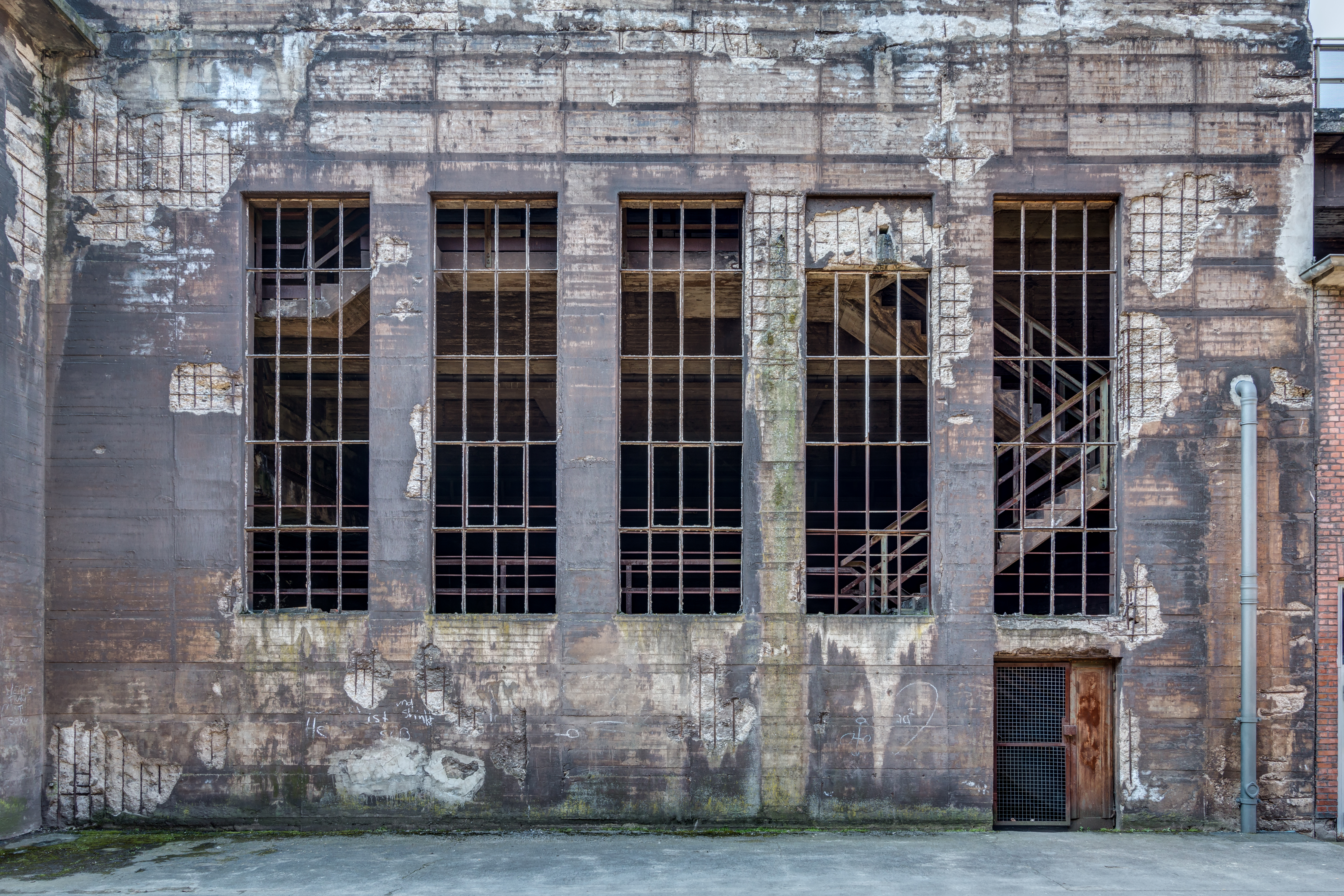
Deutsch: Hochofenstraße, Landschaftspark Duisburg-Nord in Duisburg, Nordrhein-Westfalen, Deutschland
Čeština: Průmyslový turistický park Landschaftspark Duisburg-Nord v Duisburgu, Severní Porýní-Vestfálsko, Německo
Español: Edificio en Hochofenstraße, Landschaftspark Duisburg-Nord, Duisburgo, Renania del Norte-Westfalia, Alemania
Français : Hochofenstraße, parc paysager Duisburg-Nord à Duisbourg, Rhénanie-du-Nord-Westphalie, Allemagne
Italiano: Hochofenstraße, Parco paesaggistico Duisburg-Nord a Duisburg, Renania Settentrionale-Vestfalia, Germania
Македонски: Здание во Пределниот парк Дујсбург-Север во Дујсбург, Северна Рајна-Вестфалија, Германија
Polski: Budynek przy Hochofenstraße w Parku Krajobrazowym Duisburg-Nord w Duisburgu, w Nadrenii Północnej-Westfalii, w Niemczech.
Português: Detalhe de um edifício na Hochofenstraße, Landschaftspark Duisburg-Nord, Duisburgo, Renânia do Norte-Vestfália, Alemanha
Українська: Доменна дорога, ландшафтний парк Дуйсбург-Норд у Дуйсбурзі, Північний Рейн-Вестфалія, Німеччина
|
||||||||||||||||||||||||||||||||
| Osoite |
|
||||||||||||||||||||||||||||||||
| Kuvauspaikka | |||||||||||||||||||||||||||||||||
| Esittää | Landschaftspark Duisburg-Nord – park in Duisburg, Germany | ||||||||||||||||||||||||||||||||
| Technical Specifications |
|
||||||||||||||||||||||||||||||||
| Image data |
|
||||||||||||||||||||||||||||||||
| Päivymiäry | Kuvattu 27. Tuhukuuta 2016, 14:43 | ||||||||||||||||||||||||||||||||
| Lähteh | Oma ruado | ||||||||||||||||||||||||||||||||
| Luadii |
|
||||||||||||||||||||||||||||||||
| Käyttöoigevus (Tämän tiijoston uvvellehkäyttö) |
 .svg) I. Licence
This photograph is protected by copyright law. However, it may be used for free by anyone, provided it is used in accordance with the license Creative Commons License “Attribution-ShareAlike 4.0 International” (CC BY-SA 4.0). These include, among other things, the naming of the author and the license, as well as the setting of a link to the license text or its complete imprint. The attribution should be done as follows:
Please read the text of the license carefully before using the photograph. If you do not agree with the conditions of the license or if you do not understand these conditions, please refrain from using the photo. If you have any questions regarding the license or the reuse of the image, please contact me before using it. If you do not comply with the terms of the license, you do not acquire any right to use the image. If you need another license to use, please contact the author before using.
For informations about the licence see section Licenzii or as human-readable summary or as full licence text at Creative Commons. In addition to the above, a link to the source - so this page with the descriptions and license terms - is appreciated. More information or examples of use can be found at re-use (with example file). The Attribution Generator is helpful in licensing matters.
As an alternative to the Creative Commons License CC BY-SA 4.0, the Free Art License (from version 1.3) may also be used.
II. Fairness
From printed materials and other tangible products that use that work, the user is asked to send a copy to the author as thank you. However, this is not a condition for the use of the photo, but a voluntary service. The mailing address can be requested via the contact options.
Please note that the author had quite considerable effort to draw up this file. Thus, it is only fair to comply with the conditions of free licenses listed here. In the case of violation of the license conditions, the rights granted hereunder will expire automatically.
III. Disclaimer
Please note that the license applies solely for the reuse of the photograph itself. The license doesn't grant you any right regarding the depicted object (eg, copyright or proprietary rights) or the personality rights of the person eventually shown. (See licences and non-copyright restrictions.) I do not grant any warranty that the subsequent use of the photograph is legally possible concerning the object or person shown in the photograph. You are responsible to check and respect these rights in the publication in the respective medium or country.
The author is not responsible for the accuracy of the information contained herein (description, title, etc.). Likewise, the author assumes no liability for further use. Please note the general disclaimer and please read reusing content outside Wikimedia too.
IV. Contact
|
||||||||||||||||||||||||||||||||
| Muut versiot |
|
||||||||||||||||||||||||||||||||
| Atribucii (lisenssin vaatima) | Dietmar Rabich / Wikimedia Commons / /
|
||||||||||||||||||||||||||||||||
| Lyhytosoite | https://w.wiki/9AuP, https://w.wiki/_ts8e (Shortlink) |
||||||||||||||||||||||||||||||||
| Keywords | Дујсбург, Северна Рајна-Вестфалија, Дуйсбург, Північний Рейн-Вестфалія, Німеччина, Alemanha, Alemania, Allemagne, Architectural element, Architecture, Architektur, Architekturelement, Bauwerk, Bild des Tages, Building, Denkmal, Deutschland, Duisburg, Duisburgo, Duitsland, Észak-Rajna-Vesztfália, Exzellentes Bild, Facade, Fassade, Featured picture, Fenster, Gebäude, Germania, Germany, Gewalt, Gewerbe, Gewerbe und Industrie, Handel, HDR, HDRI, HDR-Image, HDR image, High Dynamic Range Image, Hochofenstraße, Industrie, Industriefotografie, Kultur, Kulturdenkmal, Kunst, Landscape, Landschaft, Landschaftspark Duisburg-Nord, LaPaDu, Meiderich-Beeck, Museum, Nadrenia Północna-Westfalia, Natur, Německo, Németország, Niemcy, Noordrijn-Westfalen, Nordrhein-Westfalen, North Rhine-Westphalia, Park, Picture of the day, Qualitätsbild, Quality image, Renania del Norte-Westfalia, Renânia do Norte-Vestfália, Renania Settentrionale-Vestfalia, Rhénanie-du-Nord-Westphalie, Road, Schutzgebiet, Severní Porýní-Vestfálsko, Straße, Straßen und Wege, Street, Tone-mapped HDR image, Unternehmen, Verkehr, Wiki Loves Monuments, Window, Wirtschaft, 2016 | ||||||||||||||||||||||||||||||||

.jpg)
.jpg)

| Kohteen sijainti | | Tämä ja muut kuvat kartalla: OpenStreetMap |
|---|
| Kameran sijainti | | Tämä ja muut kuvat kartalla: OpenStreetMap |
|---|
| NOTE: For this image, at least three individual images were combined as a High Dynamic Range Image (HDRI) and tone mapping (or as an exposure fusion (pseudo HDRI)) and were thereby processed digitally. Therefore, this picture may not reflect reality exactly in every detail. |

|
Kuva on tallennettu osana Wiki Loves Monuments 2016 -kilpailua.
|
Arviointi
|
This image was selected as picture of the day on Wikimedia Commons for 4 April 2018. It was captioned as follows: English: Hochofenstraße in the Landschaftspark Duisburg-Nord in Duisburg, North Rhine-Westphalia, Germany Other languages:
Čeština: Průmyslový turistický park Landschaftspark Duisburg-Nord v Duisburgu, Severní Porýní-Vestfálsko, Německo. Deutsch: Hochofenstraße im Landschaftspark Duisburg-Nord in Duisburg, Nordrhein-Westfalen, Deutschland English: Hochofenstraße in the Landschaftspark Duisburg-Nord in Duisburg, North Rhine-Westphalia, Germany Español: Detalle de un edificio en el Hochofenstraße, Landschaftspark Duisburg-Nord, Duisburgo, Renania del Norte-Westfalia, Alemania. Polski: Budynek przy Hochofenstraße w Parku Krajobrazowym Duisburg-Nord w Duisburgu, w Nadrenii Północnej-Westfalii, w Niemczech. Português: Detalhe de um edifício na Hochofenstraße, Landschaftspark Duisburg-Nord, Duisburgo, Renânia do Norte-Vestfália, Alemanha. Македонски: Здание во Пределниот парк Дујсбург-Север во Дујсбург, Северна Рајна-Вестфалија, Германија. |
Licenzii
Dietmar Rabich, tämän teoksen tekijänoikeuksien haltija, julkaisee täten tämän teoksen seuraavalla lisenssillä:
Tämä tiedosto on lisensoitu Creative Commons Nimeä-JaaSamoin 4.0 Kansainvälinen -lisenssillä.
Atribucii: Dietmar Rabich
- Voit välläh:
- jagua – kopiiruija, levittiä da ezittiä tevostu
- luadie remiksoi – kebjendiä tevostu
- Nämmii ehtoloi noudajen:
- atribucii – Sinul pidäy mainita luadii, andua linku licenzieh da merkitä, ollougo luadii luadinuh muutoksii. Sidä voibi luadie hos mittumal tolkukkahal taval, ga ei nenga, ku andazit ellendiä, ku licenzienandai kannattau sinuu da sinun tämän tevoksen käytändiä.
- jua samal taval – Ku kohendannet, muuttanet libo luadinet uuttu tämän ruavon pohjal, voit jagua omua ruaduo vai tämän same or compatible license libo tämänjyttyzen licenzien mugah.
Notes
Valokuvat
|
You like this photograph? That pleases me very much! You would like to see more of my pictures? With pleasure.
Wikimedia Commons has a large number of my photographs available under a free license. This makes it easy for you and me. The license details are for each picture. The use is easier than you think, because in essence, this is just the attribution in the form I want. In addition, usage notes are listed for each picture. And if it does not fit, just ask. My contact information is also available with every photograph. |


Tiijoston histourii
Painalda päivymiäriä/aigua kaččuo, mittuine tiijosto oli silloi.
| Päivymiäry/aigu | Pieni kuva | Suurus | Käyttäi | Huomavus | |
|---|---|---|---|---|---|
| nygöine | 24. Kylmykuuta 2016 kello 10.12 | | 4 943 × 3 295 (10,82 MiB) | XRay | resolution |
| 2. Syvyskuuta 2016 kello 14.16 |  | 4 608 × 3 072 (9,29 MiB) | XRay | VicuñaUploader 1.23 |
Tiijoston käyttö
Tädä tiijostuo käyttäjii sivuloi ei ole.
Tiijoston globualline käyttö
Nämmä jällesolijat wikit käytetäh tädä tiijostuo:
- Käyttö az.wikipedia.org kohtas
- Käyttö be-tarask.wikipedia.org kohtas
- Käyttö crh.wikipedia.org kohtas
- Käyttö cv.wikipedia.org kohtas
- Käyttö de.wikipedia.org kohtas
- Käyttö en.wikipedia.org kohtas
- Käyttö hu.wikipedia.org kohtas
- Käyttö hy.wikipedia.org kohtas
- Käyttö ka.wikipedia.org kohtas
- Käyttö ko.wikipedia.org kohtas
- Käyttö lbe.wikipedia.org kohtas
- Käyttö lez.wikipedia.org kohtas
- Käyttö mk.wikipedia.org kohtas
- Käyttö os.wikipedia.org kohtas
- Käyttö pt.wikipedia.org kohtas
- Käyttö ru.wikipedia.org kohtas
- Käyttö ru.wikinews.org kohtas
- Käyttö sah.wikipedia.org kohtas
- Käyttö tcy.wikipedia.org kohtas
- Käyttö tt.wikipedia.org kohtas
- Käyttö vep.wikipedia.org kohtas
- Käyttö zh.wikipedia.org kohtas